What is the Höga Kusten Leden?
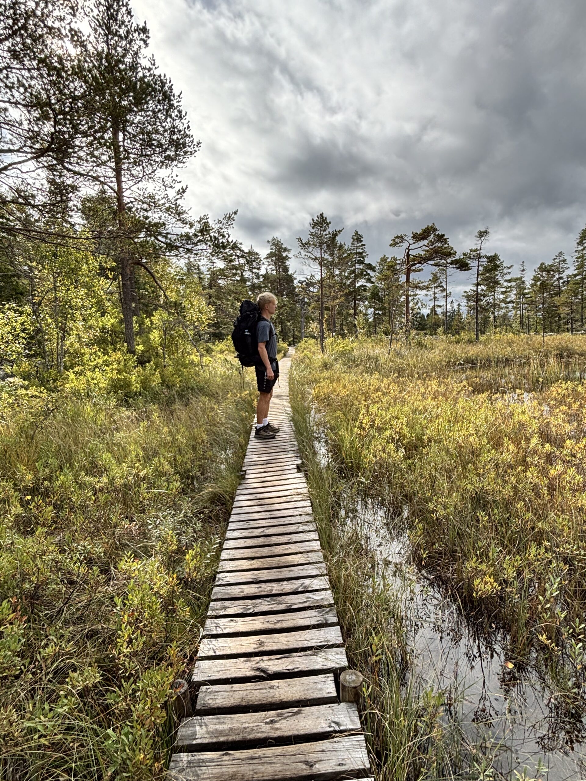
The Höga Kusten Leden is a long distance hiking trail in northern Sweden. Although lesser known than the Kuststigen or Kungsleden, it is no less beautiful and absolutely worth taking on. While other trails focus more on either the extensive archipelagos along the Swedish coast or the remote alpine regions up North, this trail follows a stretch of coast covered in forests with many small mountain tops on the way, offering extensive views over the coastal inlets, secluded coves and countless islands along every part of the trail.
Overview and General Facts
| Location | Västernorrland, Sweden |
| Length | 136 km |
| Elevation Gain | 3130 m |
| Duration | 6 – 9 days |
| Difficulty | Easy to Moderate |
| Highest Point | Skuleberget (295 m) |
| Camping | Allowed almost everywhere |
| Trailhead | Hornöberget |
| Endpoint | Örnsköldsvik |
| Direction | Both directions possible |
| Best Time | June – August |
How long does it take to hike the entire length of the Höga Kusten Leden?
Depending on your fitness level hiking the entire distance of the Höga Kusten Leden can take anywhere from 6 to 9 days. While the official website states 5 to 7 days, this estimate seems pretty ambitious to me. It took us 7 days in total for the entire thing and going any faster would have been harder if not impossible without leaving out some of the best viewpoints along the way.
We actually met a couple hikers, who trusted the official assessment and were pretty surprised to find out that they had planned too little time. It is therefore best to plan too many days rather than too few. Only hiking parts of the trail is also possible, as there are many points along the way, which intersect with the E4 highway, where you can take the bus back to your starting position from.
If you are hiking with just a light backpack and stay in actual accommodation instead of a tent, then it may be possible to complete the trail in less than 7 days due to better recovery and less weight on the back. With the additional weight of camping equipment and the associated time needed to pitch the tent and pack it up again the next morning it would be next to impossible to cover enough kilometers each day in my opinion.
Trail Route & Stages
For each of the 7 stages it took us to hike the trail, you can find a detailed description via the links below. There I explain, what the stage was like, what the highlights were and were we slept. I go into more detail how the shelters looked like and how we managed our provisions during that time. Reading each guide carefully allows you to plan each day specifically for your needs, whether you plan to camp with or without a tent or choose to stay in accommodation. Each Stage described here leaves room for additional stops like viewpoints, supermarkets or places to eat. Most of the days we finished off with a couple kilometers more than described below just because of what we needed or wanted to do in addition to hiking the actual trail that day.
Stage 1: Hornöberget – Halsviken
The first stage of the Höga Kusten Leden starts off with a bang offering beautiful views over the surrounding seas and amazing camp sites.
- Distance: 18,2 km
- Elevation Gain: 330 m
- Difficulty: Moderate
- Highlights: Svartnorbron, Kulberget, Valkallen
Stage 2: Halsviken – Gavik
Heading away from the coast, this stages leads up to the top of Nilsberget before leading you to the sleepy coastal bays of Gavik, offering spectacular views along the way.
- Distance: 17,6 km
- Elevation Gain: 380 m
- Difficulty: Moderate
- Highlights: Nilsberget, Svartviken
Stage 3: Gavik – Eriksstugan
Hiking away from the coast once again, today’s route leads along one dreamy lake after another.
- Distance: 17,0 km
- Elevation Gain: 470 m
- Difficulty: Easy
- Highlights: Vågsfjärden, Vedasjön, Körningsberget
Stage 4: Eriksstugan – Skuleberget
With a lot of ups and downs, this stage leads along many good viewpoints before reaching the most famous tourist attraction in Höga Kusten: Skuleberget.
- Distance: 19,9 km
- Elevation Gain: 350 m
- Difficulty: Easy
- Highlights: Fäberget, Skuleberget
Stage 5: Skuleberget – Skuleskogens NP
The hardest, but most rewarding stage awaits on Day 5 with steep climbs, unforgettable views and raw nature.
- Distance: 20,6 km
- Elevation Gain: 790 m
- Difficulty: Hard
- Highlights: Skuleberget, Getsvedjeberget, Skuleskogens NP
Stage 6: Skuleskogens NP – Balesudden
Heading back down from the National Park into civilization and right back out again to one of the best viewpoints along the entire Höga Kusten.
- Distance: 19,3 km
- Elevation Gain: 280 m
- Difficulty: Moderate
- Highlights: Skuleskogens NP, Balesudden
Read the full Stage 6 guide
Stage 7: Balesudden – Örnsköldsvik
Reaching the finish line, this stage is the last one on the Höga Kusten Leden. Passing along the beautiful Bäckfjärden, the trail slowly makes it’s way into the city center of Örnsköldsvik.
- Distance: 22,6 km
- Elevation Gain: 430 m
- Difficulty: Moderate
- Highlights: Bäckfjärden, Varvsberget
Read the full Stage 7 guide
Where to sleep on the Höga Kusten Leden
Camping
Sweden’s law knows the concept of Allemansrätten. This includes the freedom to roam on public and private land for the purpose of recreation and exercise. This does not include sleeping in somebody’s front yard of course but pitching your tent anywhere in the woods is completely legal. Excluding nature protection zones of course. The main rule here is to leave no trace and be respectful to the environment. No trash left behind, no disturbing noises and no destruction of the natural environment around you are some of the basics you should know.
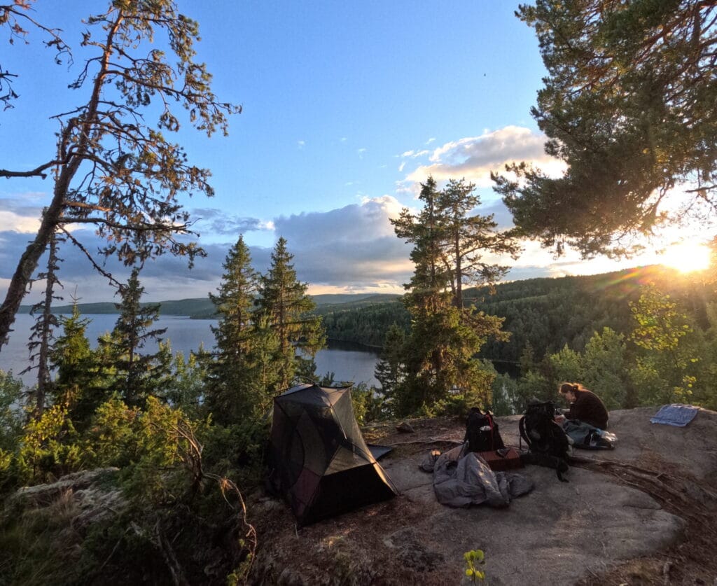
In reality, although you could of course pitch your tent anywhere in the wilderness it is much more comfortable to set it up in one of the many spots designated for camping. We always used these spots, because not only are they at the best possible locations concerning your surroundings, but they also provide amenities such as fire wood, an outhouse and wooden shelters in case of rain and wind. In addition to that, you only stay in places, which already have been influenced by human activity and do not encroach into completely wild environments.
Most of the time we were completely alone in these spots, although there would have been room for more tents. In the cases that we did meet other people there, the spot was always large enough to be able to keep a bit of a distance to each other. I therefore highly recommend using them. The locations can be found on the official website or are further explained in my detailed descriptions for each stage.
Accomodation
If camping is not your style, it is also possible to hike the Höga Kusten Leden while staying in actual hotels and B&B’s along the way. The problem here is, that there are not too many options to choose from and therefore your stages need to be planned according to the availability of accommodation. To give you an example: After starting at Hornöberget the two next accommodations are in Lövvik 11 kilometers in and in Gavik, 37 kilometers in. This means that on the first day you can either walk 11 kilometers or 37 kilometers. Both are not ideal.
Therefore it can be quite a challenge to actually pull it off and it of course dampens the „wilderness of Northern Sweden“ experience. The accommodations that we encountered were rather pretty though and staying in one of them to rest for a night, while camping the other nights could have been a much more relaxing experience compared to staying in the tent the entire time.
How to find water and food on the trail
Supermarkets and Gas Stations
At several points along the trail, there are stores to replenish your supplies. The challenge is to plan ahead and pack accordingly. The goal is to never run out of calories to eat, yet never carry unnecessary amounts of provisions with you. At the most you will have to carry food for two consecutive days but on most days you will pass someplace to buy new stuff, so it is far easier to plan your food then for example on the Kungsleden. Below there is a comprehensive list of all stores along the way with way-points:
| km 45,9 | ICA Nordingrå |
| km 58,7 | COOP Ullånger |
| km 58,8 | OKQ8 gas station |
| km 72,7 | ICA Docksta |
| km 73,2 | Circle K gas station |
| km 104,1 | COOP Köpmanholmen |
| km 132,1 | Hemköp Örnsköldsvik |
| km 132,7 | COOP Hörnet |
Restaurants
Several restaurants and cafés can be found along the Höga Kusten Leden. These can be perfect for some actual freshly cooked food and for recharging your power banks. Creating a comprehensive list can be tricky though, as many restaurants only open during the tourism season between June and August. As we hiked the trail in September, many were closed already. Here is the best summary I could therefore come up with:
| km 11,4 | Pizzaboden Lövvik | All Season |
| km 27,8 | Östano Skafferi | June – August |
| km 43,2 | Konstbyns Kafé | June – August |
| km 46,1 | Vallen Pizzeria | All Season |
| km 58,6 | Restaurants in Ullånger | All Season |
| km 69,2 | Kustladan Restaurang | All Season |
| km 72,8 | Restaurants in Docksta | All Season |
| km 76,5 | Toppstugan Skuleberget | All Season |
| km 79,2 | Naturum Höga Kusten | April – October |
| km 105,2 | Lailas kök & pizzeria | All Season |
| km 130 – 136 | Restaurants in Örnsköldsvik | All Season |
We opted to use a restaurant once a day when we were to walk past one on that stage. Although a bit more expensive than supermarket food, we enjoyed not carrying additional provisions, alleviating our bag of some additional weight. I can especially recommend the Toppstugan Skuleberget, as it sits on top of the Skuleberget Mountain and offers an amazing view from it’s terrace with exceptional food.
Wild Water Sources
Finding water on the Höga Kusten Leden was far less of a challenge then we expected. We did not bring a water filter and bought fresh drinking water at the stores, whenever we passed by one. During times, where there was no store, we used water sources in the forest, which are also marked on the official trail maps. I recommend using them to find credible sources instead of just drinking from random streams.
Most water sources are in the form of small wooden boxes covering up actual natural springs. The water is often very clear, really cold and totally refreshing. We drank the water without a filter and nothing bad happened to us. But if you want to be extra sure, bring a water filter or just simply boil the „forest water“ before consumption.
How to travel to Höga Kusten
Getting to Höga Kusten can look daunting on a map but it is actually pretty straightforward. Depending if you plan to hike in the official direction (South to North) or the other way around, you have to base yourself in either Härnösand or Örnsköldsvik.
By Car
Coming by car is pretty straightforward, as both towns lay right on the E4 Highway, which is the coastal road connecting Stockholm with northern cities like Umeå and Luleå. Just follow it until you reach either town. From there it is advisable to take the local bus to the trailhead (see getting to the trailhead section), as there are no secure parking spots outside of either town to park your car for a week. Therefore getting back to your vehicle also needs to be done with either bus or train.
By Public Transportation
In order to travel to Höga Kusten by public transportation you will first want to fly into Stockholm Arlanda, the main airport of Stockholm. There are many flights from the airport to a multitude of European destinations, as it is a hub for the low-budget airline Ryanair.
Within the Arlanda Airport you can then seamlessly connect to Intercity Trains through the train station right below the terminals. From there, take a direct train to either Härnösand or Örnsköldsvik. Check connections on the official SJ Website. There are a multitude of connections offered there, but if you can, try to go for the direct option. It saves a lot of time and stress, as you can just relax and sit back until you reach your destination.
Getting to the trailhead
The southern trailhead is located at the Hornöberget Rastplats. It can be reached from Härnösand with bus line 50. The bus will drop you off at the E4, so you need to hike up to the starting point. Before heading off on the trail pay a visit the the tourist information center, where you will find useful information about all sections of the trail.
The northern trailhead is located right in the city center of Örnsköldsvik on the Storatorget, so you can probably get there on foot. Sadly there seems to be no real tourist information there, where you can get all the maps on paper, but all of them can also be found on the official trail website.
To get back to Härnösand or Örnsköldsvik, I recommend using the train, as it is the fastest and most comfortable option to travel between both towns. If you only intend to hike parts of the Höga Kusten Leden and need to get back to your starting point, the train is not an option, as it does not stop anywhere near the trail. Bus line 50 on the other hand works perfect for this, as it connects all major towns along the E4 between both cities. It runs hourly and takes just under 2 hours for the 100 km drive.
When to hike the Höga Kusten Leden
| June – August | high season most shops are open good weather and warmer temperatures likely |
| Mai, September | shoulder season most cafés/restaurants closed cooler nights and more rain |
| October – April | Off-Season everything closed apart from supermarkets cold and pretty dark icy and/or muddy conditions prevelant |
What to pack for the Höga Kusten Leden
If you have already done other long distance trails with a tent, then you can probably skip this section. If not, I provide you with a comprehensive packing list, that encompasses everything you will probably need without over-packing. To fit all the equipment mentioned below, a 45-55 liter backpack should suffice.
Camping Equipment
- Trekking Tent (3-season)
- Sleeping Bag (at least down to 5°C)
- Air Mattress (R-Value at least 3)
- Inflatable Pillow
- Optional: additional foam pad for sitting / sleeping on
Clothing
- Underwear
- Hiking socks
- Thermal base layer
- Short and Long Hiking pants (preferably rain-proof)
- Rain-Proof and Wind-Proof Jacket
- Pullover
- Microfiber towel
- Hiking boots or trail shoes
- Beanie
- Optional: slides
- Optional: swim shorts
- Optional: more clothing, when hiking early/late in the season
Food and Water
- Gas Burner
- Gas Cartridge (at least 230g per person)
- Zip-lock bags for waste
- Small pot
- Pocket knife
- Camping spoon and fork
- 2,5 l water storage capabilities per person
- Enough space for food in the backpack ( 2 days worth of food)
- Optional: mug for coffee or tea
- Optional: water filter
Technical Equipment
- Rain cover for the backpack
- Toothbrush
- Toothpaste
- Unscented soap bar
- Toilet paper
- Sunscreen
- Deodorant
- Bug spray
- First Aid Kit
- Power Bank (20000 mAh)
- Head Lamp
- Fast Charger
- USB-C cable
- Optional: sunglasses
- Optional: Additional Power Bank
How difficult is the Höga Kusten Leden?
The Höga Kusten Leden is in my opinion of easy to medium difficulty. Compared to other trails I hiked, there are plenty of water sources and camp sites along the way, while food and actual accommodation occur more sporadically.
From a technical standpoint the trail is not difficult at all with no mountain higher than 300 m and most trails exceptionally well cared for by the local authorities. Everything is marked out perfectly and it would be hard to get lost even without any map. Information concerning everything you need is available plentifully both online and in the many visitor centers in the area.
If you have camped before and have some experience hiking it should therefore be absolutely doable even if this is your first real long distance hike. With the right planning and basic 3-season outdoor equipment you cannot go wrong here.
If you only intend to stay in accommodation this trail is certainly possible, but maybe not quite the experience you are looking for. The stages, which one would have to take on here are either pretty long or too short, so other Swedish long distance trails would probably suit you better to be honest.
HKL Map
Maps of the trail with all additional information for each section can be found on the official website. The maps you see there are the same that you can find in paper at the tourist information centers at different parts along the Höga Kusten Leden. I recommend using the paper maps, whenever possible to be independent from your power supply in case the power bank runs empty.
The official maps are sometimes not quite detailed enough, especially in areas with many trail junctions, turns and twists. For this purpose I created a Komoot Map for the entirety of the trail, that you can use in addition to the paper maps: